
(Cleveland)- National Weather Service forecasters say a strong low-pressure system will bring gusty winds to North Georgia Monday night and widespread showers and thunderstorms to much of Georgia Tuesday.
 The weather service has issued a Wind Advisory that goes into effect Monday evening for several Georgia counties north of the I-85 corridor for non-thunderstorm wind gusts of 35+ mph ahead of the cold front.
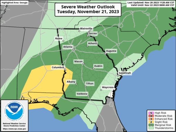
Showers will begin to move into Georgia from the west early Tuesday morning with the main line of storms moving in late Tuesday morning through the afternoon. Damaging thunderstorm wind gusts will be possible with any strong to severe storms that develop forecasters advise.
On the positive side, beneficial rainfall amounts of 1-2 inches will be possible north of the I-85 corridor.
The cold front will shift into Southeast Georgia by Tuesday evening and storms will diminish by early Wednesday morning. Persistent light rainfall will continue in Southeast Georgia on Wednesday while the rest of Georgia clears out and cools down from northwest to southeast.
The weather service says mild, Autumn-like weather will settle in for Thanksgiving Day and continue through the weekend across the state with slight rain chances ahead of a reinforcing cold front that will move through on Saturday.


