
 (Cleveland)- The latest information from the National Weather Service indicates some areas of the state could see some severe weather overnight through Thursday morning.
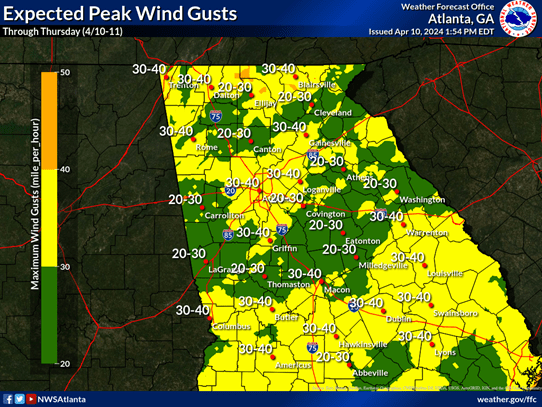
Don Strength, White County Public Safety Division Chief says, it now appears the greatest risk for White County this evening through tomorrow morning will be non-thunderstorm wind gusts 20–40 mph. The 40 mph gust will likely be on the ridge tops with 25-30 mph gust county-wide.
Strength says this will certainly be strong enough to bring down a few trees. A few strong to marginally severe thunderstorms will be possible but the best chance will be south of I-20 tonight. Strength pointed out that a wake Low is forming over Mississippi which could enhance the wind tonight as it tracks over north Georgia.
White County Emergency Operations Center is monitoring this developing weather event and Strength said they will post updates as necessary.


