
By: J.K. Devine
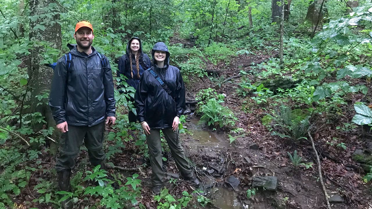
UNG students Brittany Mann and Katelynn Comer along with Dr. Jacob McDonald, assistant professor of geography and geospatial science at UNG, hiked through the mountains and valleys surrounding Helen and Sautee Nacoochee, Georgia, to find and map the original Unicoi Turnpike. Their research produced a map of the Unicoi Wagon Trail for the Sautee Nacoochee Community Association (SNCA).
For the past three years, University of North Georgia (UNG) student Brittany Mann has studied textbooks, used technology to construct maps and learned about the work her professors in the Lewis F. Rogers Institute for Environmental & Spatial Analysis have completed. But this summer, she put those skills to use.
Mann, fellow student Katelynn Comer and Dr. Jacob McDonald, assistant professor of geography and geospatial science at UNG, hiked through the mountains and valleys surrounding Helen and Sautee Nacoochee, Georgia, to find and map the original Unicoi Turnpike or wagon trail.
“We went on long hikes looking for the trail itself, collected coordinate points along the way, mapped out our findings, interviewed local residents to see if they had any new leads, and did lots of research,” Mann said.
Their research produced a map of the Unicoi Wagon Trail for the Sautee Nacoochee Community Association (SNCA). The nonprofit initiated the collaborative project with UNG to find, digitize and map the historic trail. Once complete, the maps will be shared through SNCA’s smartphone app, “The Heart & Heritage of the Northeast Georgia Mountains,” and Google Earth Pro.
“The trail was the first vehicular route to link east Tennessee, western North Carolina and north Georgia with the head of navigation on the Savannah River system,” Alan Hall, president of SNCA Board of Directors, said. “Much of the 200-plus-year-old trail has vanished under plows and bulldozers, but important sections remain.”
“I looked at the area, downloaded the data and immediately saw something that didn’t look natural,” McDonald said, explaining how he found a potential portion of the trail south of the Unicoi Gap at the border between White and Towns counties. “In the forest, where there is no land development, topographic inconsistencies can indicate potential trail remnants. But in areas with lots of development, like Helen, the potential route was much more difficult to determine.”
In areas with homes and businesses, McDonald and his team relied on Hall and residents to continue tracing the path.
“Alan Hall pulled previous research and gave us landmarks to connect the route,” McDonald said. “By knowing the places the trail passed, we could figure out a most probable route.”
Mann, a senior pursuing a degree in environmental spatial analysis, said her favorite part was talking to the residents.
“They got so excited sharing their stories about the Unicoi Trail. These stories had been passed down for generations,” the resident of Warner Robins, Georgia, said. “This project made me feel very fulfilled and confident that I chose the right career.”
McDonald said the project showed both students how their knowledge can be used in the real world.
“The methods and technologies that we teach in our classes aren’t just for observing and studying the present,” McDonald said. “We can also learn about the past by combining that classroom theory with technologies in a way that was not possible 10-15 years ago.”


